Here we have my favourite photoset of them all! After Paoay (and a stopover at Laoag for a drive thru lunch, something rare for me as I don't eat fast food often), we had a long trip ahead to get to Burgos.
I quite like road trips, and I had the chance to be in the front seat because I was the navigator. Staying awake the entire trip is a small price to pay to be able to get good views for pictures!
Cape Bojeador Lighthouse! It's the lighthouse that signifies you're near the northmost tip of the main Luzon island. This is the only picture I got as it was raining and crazy traffic to get up there. Still pretty from afar, though!
Coastal roads are so pretty! I honestly wish a lot more highways had views like this. It reminded me a lot of Ireland as we drove by. Even the weather was on point!
Next stop - Burgos Wind Farm! We were supposed to go to the Bangui Windmills but settled for the ones near Kapurpurawan instead to save time. We missed the opportunity to see the Pililia Wind Farms in September, so to finally see these was a relief!
I graduated an Environmental Science major, so seeing these alternative energy farms made me kind of giddy. There was also a solar farm near this. It's a dream of mine to see most of the Philippines powered my renewable energy. Hopefully in my lifetime!
This seems to be everyone's favourite picture, haha! This was opposite the Kapurpurawan (what a mouthful) Rock Formation, and does it not remind you of the Cliffs of Moher? It even has the fog that I remember surrounded the Cliffs on our way to Inis Oirr. Looks like you don't have to go all the way to Europe to get a view like that!
It's quite cool how there was this large wetland before it reached the sea. The place is quite cinematic if I'm honest. I hope they film somewhere here, I'm sure it would look beautiful on the big screen!
I couldn't find any plaque that describes what this is, so I'm guessing it's a deity that is famous in the Ilocos region? I'm actually a huge fan of Philippine Mythology (and mythology in general) so I'd love to see more of these sculptures in other locations!
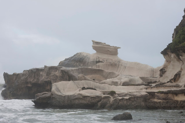
The Kapurpurawan Rock itself! Amazing piece of sedimentary rock. Mini science lesson: sedimentary rock is a type that forms by the pressure exerted by water. It usually takes thousands of years to form. How incredible is it that this rock formed into a shape like this?
Aha, a sudden face! Forgive my expression. This was taken amidst very cold ocean winds and soft but persistent rain. Will there ever be a picture of me traveling that doesn't involve wind swept hair?Stay tuned!
The sun came out for a bit, long enough for me to snap this. Everything looks so much livelier with a little sunlight, don't you agree?
I love this picture in particular as it appears very cinematic. Maybe there's potential for me to be in cinema? Ha, I wish!
It was a long drive, but we finally made it to Pagudpud! This town is at the tip of the main Luzon island, and the furthest point north other than Batanes and the Cabuyao Islands. I was pretty psyched to have reached this far. Next time, maybe the southernmost tip of Luzon?
We came all the way just to see this, the Patapat Viaduct. It was very stormy and windy so a lot of my shots came out quite dark, but I think it makes for a very interesting shot nonetheless. There are many of these already taken with sunlight online, anyway!
This is my personal favourite picture. I was leaning off the bridge perilously just to get this shot, but it was more than worth it. Quite an amazing site this viaduct is, don't you think? I wish we had more coastal roads like these!
And so ends the Ilocos Norte portion of this series. Next up will be the highly anticipated historic city of Vigan!


No comments:
Post a Comment